Late in the evening of August 31, the eastern provinces of Afghanistan were shaken by a powerful earthquake measuring 6.0 on the Richter scale. The epicenter was located approximately 27 kilometers from Jalalabad, with the focus at a shallow depth of around eight kilometers. The tremors destroyed dozens of mountain villages in the provinces of Kunar and Nangarhar, near the border with Pakistan.
According to official data as of September 2, in Kunar Province alone, more than 1,400 people lost their lives and over 3,000 were injured. In neighboring Nangarhar, dozens were killed and hundreds wounded. The quake has been recognized as one of the most devastating in Afghanistan in recent decades.
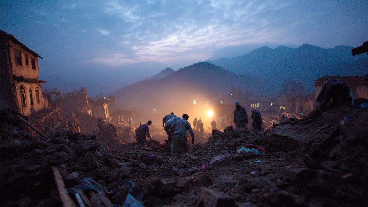
Eyewitness accounts highlight the scale of the disaster. A fourteen-year-old boy from the village of Wadir was injured when his house completely collapsed, killing five members of his family. He managed to rescue only his father, whose voice he heard under the rubble. In total, more than 5,400 homes were destroyed, and many villages were left in ruins.
Access to some of the hardest-hit areas remains limited: narrow roads are blocked by rockfalls and landslides, while the mountainous terrain hampers the delivery of aid. Helicopters are evacuating the injured to the nearest hospitals, mainly in Jalalabad.
Due to a shortage of professional rescuers, local residents are conducting the search and rescue operations themselves. Without machinery, they are clearing the debris of mud-brick and stone houses with their bare hands. Several days after the disaster, people are still trapped under the rubble, but there are too few helpers to save them, and the death toll continues to rise.
Experts note that the growing number and magnitude of earthquakes, along with other natural disasters, correspond to a mathematical model developed by the international team of scientists of ALLATRA. Further details are presented in the report "On the progression of climatic disasters on earth and their catastrophic consequences."