Super Typhoon Sinlaku became one of the most powerful and at the same time anomalous tropical cyclones in the western part of the Pacific Ocean. It formed over the waters of Micronesia as an ordinary thunderstorm system, but then began to develop at an unusually high rate. In just about 72 hours, it intensified from a tropical depression into a Category 5 super typhoon, with wind speeds exceeding 174 miles per hour.
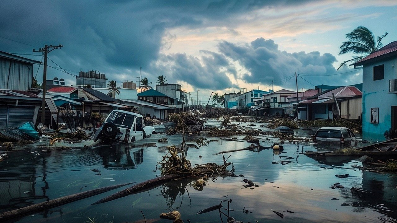
The typhoon caused widespread destruction: homes were destroyed, roads and port infrastructure were damaged, and there were serious disruptions to power supply and water delivery. In some areas of the state of Chuuk, one of the Federated States of Micronesia, up to seventy-five percent of the electrical distribution networks were damaged.
Communications, including emergency service channels, were almost completely paralyzed, which significantly complicated rescue operations. As of April 20, at least four people were reported dead, though the number of victims may rise as information comes in from hard-to-reach areas.
The main impact of the storm struck the Northern Mariana Islands. The eye of the typhoon passed over the islands of Saipan and Tinian, where sustained winds of about 145 miles per hour were recorded, with gusts reaching up to one 175 miles per hour, corresponding to a Category 4 storm on the Saffir–Simpson scale. Storm surge also played a significant role, with wave heights reaching up to approximately 29.5 feet in some areas, causing severe coastal destruction.
Part of the population was evacuated to special shelters, and hundreds of tourists were stranded due to flight cancellations. The island of Saipan, known for its resorts and diving, was effectively paralyzed.
During the passage of the typhoon, six people who had been aboard a damaged vessel went missing after contact with it was lost on April 16. The United States Coast Guard conducted search operations, but after four days they had still not been found.
Experts note that Sinlaku demonstrates a combination of several anomalies.
First, there was extremely rapid intensification. At one stage of the typhoon’s development, its wind speed increased by about 75 miles per hour within 24 hours, which is close to the upper limits of observed intensification rates.
The main factor behind such rapid strengthening was abnormally warm ocean water. In the area southeast of the island of Guam, where the cyclone was gaining strength, sea surface temperatures reached approximately 86 to almost 90 degrees Fahrenheit, which is significantly above the climatic norm, especially for April.
This is the second anomaly. The peak of the typhoon season in the western Pacific typically occurs in June, so such a powerful cyclone in April is an extremely rare phenomenon.
Third, satellite observations recorded an unusual vertical structure of the storm: the temperature at the tops of the clouds in the central convection zone dropped to about negative one hundred forty degrees Fahrenheit.
Such values are close to the level of the tropopause, the upper boundary of the troposphere. This means that the upward air currents within the typhoon were so powerful that they penetrated the upper layers of the atmosphere. This kind of structure indicates a highly energy-efficient system, in which the latent heat of the ocean is converted into rotational energy as quickly as possible.
Additional features of Sinlaku included its large size and slow movement. According to the United States National Weather Service in Guam, the zone of typhoon-force winds extended for approximately 275 miles from the center. In areas where the cyclone almost stalled, destructive winds and torrential rains persisted for up to 48 consecutive hours, significantly increasing the damage.
It is worth noting that in recent years the United States has experienced an unprecedented series of Category 4 and Category 5 tropical cyclones.
Since 2017, the country has already experienced about ten such events: seven on the mainland United States, one in Puerto Rico, and two in the Northern Mariana Islands. This number is comparable to what occurred over the previous 57 years. In other words, this is not about random spikes, but about a sharp transition to a new statistical norm of extreme storms, in which Sinlaku becomes part of a broader and alarming trend.
To understand why climate events are developing according to such a dangerous scenario, watch the video “Why Is the Ocean Warming Up So Fast?”
Publication of this material provides an opportunity for open discussion and does not in itself imply institutional endorsement, confirmation, or scientific verification of the views expressed. The material does not constitute an official statement, expert opinion, or professional advice.